Official tourism website for Mourne Mountains and Ring of Gullion
En

Central Mournes

Co Down
Central Mournes

Book Tickets Online

About

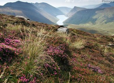
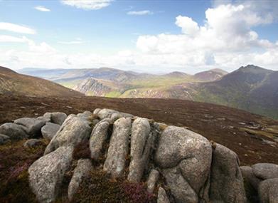
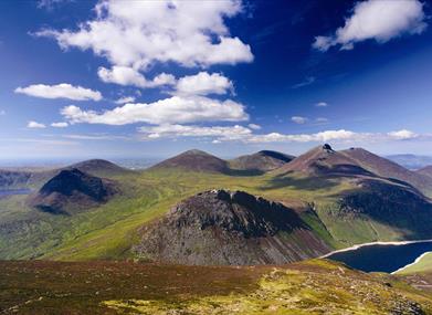
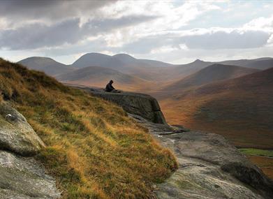
A circular route in the central Mournes taking in sites such as Annalong Wood, Slievelamagan, Ben Crom Reservoir, Cove Mountain and Annalong Valley, with views over the Irish Sea and to the Isle of Man.

Start Point:
J345219

Finish Point:
J345219

Route:
From Carricklittle car park, take the track leading up towards the mountains for 1km and cross the Mourne Wall using the stile/gate provided. Continue along the flat path for 1.8km keeping the Annalong Wood on your right. At the end of the wood, continue along the main path ascending towards the craggy outcrop of Percy Bysshe. This was used for bombing practice from off-shore ships during World War II. The path forks before this craggy outcrop, you should bear left passing the Blue Lough (on the right). Continue for another 500m to reach the col between Slieve Binnian and Slievelamagan (704m). You will see the path coming off Binnian on your left and a path leading up Slievelamagan on your right. Take this path to the right and continue to the col between Slievelamagan and Cove mountain. From here follow the path over Cove Mountain along the top of the crags. Continue along this path northwards to Slieve Beg passing the Devil's Coach Road. Care should be taken here, especially in windy conditions. At the col between Slieve Beg and Slieve Commedagh, where the path meets the Brandy Pad, you should continue cross-country in a southerly direction for 250m to pick up the path that follows the Annalong River. Continue down this path for 3.25km, until you reach the wall at the northern end of the Annalong Wood. Follow the wall up to where it meets the main Carricklittle track again and retrace your steps back to the car park.

Distance:
9.9 miles

Terrain:
Unsurfaced mountain paths

Point of interest:
Annalong Wood, Blue Lough, Slievelamagan, Cove Mountain, Slieve Beg, Annalong River

Facilities:
Car park available at Carricklittle.

Nearest town:
Hilltown

OS map:
29

Accessible terrain:
no

Accessible signage:
no

Facilities

Provider Preferences

  • Free (parking charges may apply)

Map & Directions

What's Nearby

  1. Annalong Cornmill has been beatifully restored and is situated by the pretty Annalong…

    2.28 miles away
  2. The Silent Valley Reservoir was built to gather water from the Mourne Mountains and is…

    2.55 miles away
  3. Provides a first class service for visitors to Northern Ireland and for local residents.

    5.12 miles away
  1. The Nautilus Centre overlooks Kilkeel's busy and picturesque fishing port and houses the…

    5.18 miles away
  2. Donard park is a beautiful park located in the lovely town of Newcastle County Down, next…

    5.61 miles away
  3. The Mourne Wall is 22 miles long and consists of natural granite stone which was…

    5.64 miles away
  4. The Mourne Coastal Route has a few start off points from the County Down coastline,…

    5.92 miles away
  5. The High Mournes Scenic Loop delves into the very heart of the famous Mourne Mountains…

    5.92 miles away
  6. Newcastle's Parks consist of outdoor facilities at the Castle and Island parks. Castle…

    5.93 miles away
  7. Spelga Dam Reservoir sits in the heart of the Mourne Mountains, located approximately 10…

    5.98 miles away
  8. The Electric Brae is a hill at which Newton's discovery, the law of gravity, is defied…

    5.98 miles away
  9. Situated on the "Winding Road to Clanawillan" (Trassey Road), Meelmore Lodge is the best…

    6.12 miles away
  10. Newcastle Beach is a popular seaside resort and tourist destination located on the South…

    6.26 miles away
  11. Tollymore Forest Park has panoramic views of the surrounding mountains and the sea at…

    6.61 miles away
  12. Maghera Church and Round Tower is of major historical importance and is among many…

    7.74 miles away
  13. This 5 mile stretch of golden sands is still the essence of the resort and is hugely…

    7.82 miles away
Previous Next

Map & Directions

Road Directions

The walk starts at Carricklittle car park. To get here follow the Moneydarragh Road out of Annalong for 1.3 km, continue straight on at the crossroads on the Oldtown Road for 2.4 km, Carricklittle car park is at the end of the Oldtown Road.

Public Transport Directions

Translink - journeyplanner.translink.co.uk

View Maps and Visitor Guides
View what the Mourne Mountains & Ring of Gullion has to offer and some of the best things to see and do during a visit.
E-newsletter sign up
Sign up for the Mourne Mountains & Ring of Gullion newsletter for inspiration and travel tips.
Back to Top

Visit Mourne

Tourism Northern Ireland

Geopark

>

Don't Miss