Official tourism website for Mourne Mountains and Ring of Gullion
En

Granite Trail (Bogie Line & Drinneevar Loop)

Co Down
Granite Trail (Bogie Line & Drinneevar Loop)

Book Tickets Online

About

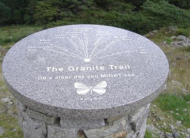
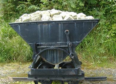
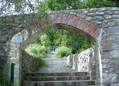
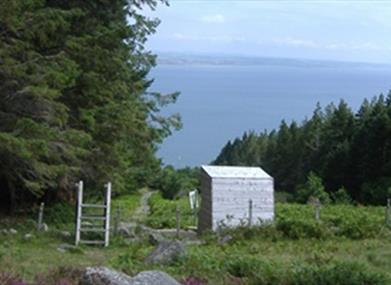
Covering a relatively short distance from coast to open moorland, the Granite Trail offers the opportunity to see artifacts from the once thriving granite industry of Mourne. Differing natural habitats can be enjoyed as you walk through coniferous forest and mature woodland beside mountain streams and rivers.

Start Point:
J381296

Finish Point:
J381296

Route:
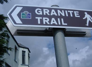
There are 3 component parts to this trail, providing the walker with a range of possible options or combinations.  • Bogie Line • Drinneevar Loop • Donard Loop Starting from NEWCASTLE HARBOUR (Bogie Line & Drinneevar Loop) Walk up to the main Newcastle – Kilkeel road (beside the Harbour Inn). Cross the road with care and continue up Bogie Hill and up onto King Street. A “Granite Trail” sign marks the direction to the start of the old BOGIE LINE, a cleared strip of forest on a 1 in 3 incline up towards Millstone Quarry. At the top of Donard Wood, cross the stile to access the DRINNEEVAR LOOP.  Follow the narrow path to your left hand side which takes you to a 2nd stile over a dry stone wall.  Cross the stile and continue along the path which leads upwards into the hillside. You will then descend briefly before taking the linear path to your right hand side, which leads up to Drinneevar Quarry (accessed through a gateway in the wall).  Here you can see remnants of the Granite Industry, including stones that have been cut using the plug and feathers technique.  Retrace your steps back along the linear route until you come to a 3rd stile which takes you back onto a forest road.  Follow the road until you reach a fork in the road. Take the left hand road and continue until you reach the BOGIE LINE. Turn right to descend onto Bogie Hill and the main A2 road.  NB – the trail on the open mountainside is very narrow and is not waymarked, in order to minimise visual disruption.  WARNING - The trail includes quarries with loose spoil, old workings and unprotected drops.  It is recommended that visitors keep to the trail.

Distance:
3 miles

Terrain:
Steep inclines, forest tracks

Point of interest:
Harbour and Town, Natural Habitat

Facilities:
Wide range of eateries to suit all tastes in Newcastle.

Publication:
The Granite Trail, Newcastle, Co. Down

Publication availability:
You can pick up a copy of this at Newcastle Tourist Information Centre. Tel: 028 4372 2222. Alternatively, it is available to download on this page.

Nearest town:
Newcastle

OS map:
Sheet 29

Accessible terrain:
Steep ascents and descents, concrete paths & steps, off road paths on open hillside and through forest. The path is uneven in places with roots, rocks etc. May be slippery.

Facilities

Provider Preferences

  • Free (parking charges may apply)

Map & Directions

What's Nearby

  1. Donard park is a beautiful park located in the lovely town of Newcastle County Down, next…

    0.68 miles away
  2. The Mourne Wall is 22 miles long and consists of natural granite stone which was…

    0.72 miles away
  3. The High Mournes Scenic Loop delves into the very heart of the famous Mourne Mountains…

    0.92 miles away
  1. The Mourne Coastal Route has a few start off points from the County Down coastline,…

    0.92 miles away
  2. Newcastle's Parks consist of outdoor facilities at the Castle and Island parks. Castle…

    0.93 miles away
  3. Newcastle Beach is a popular seaside resort and tourist destination located on the South…

    1.14 miles away
  4. This 5 mile stretch of golden sands is still the essence of the resort and is hugely…

    2.54 miles away
  5. Maghera Church and Round Tower is of major historical importance and is among many…

    2.87 miles away
  6. Tollymore Forest Park has panoramic views of the surrounding mountains and the sea at…

    3 miles away
  7. Murlough National Nature Reserve is a fragile 6000 year old sand dune system owned by the…

    3.15 miles away
  8. The Maize Maze is the only one of its kind in Northern Ireland. A massive 6 acre field of…

    4.05 miles away
  9. Set in spectacular surroundings overlooking Dundrum inner Bay these fine Georgian…

    4.27 miles away
  10. Situated on the "Winding Road to Clanawillan" (Trassey Road), Meelmore Lodge is the best…

    4.64 miles away
  11. Believed to have been built in or around 1177, Dundrum Castle was built by John De Courcy…

    4.77 miles away
  12. A small car park for visitors is located off the Drumnaquoile Road and an extensive…

    4.84 miles away
  13. Castlewellan Peace Maze is located in Castlewellan Forest Park on Forest Park View,…

    5.11 miles away
Previous Next

Map & Directions

Road Directions

There is a car park available at Newcastle Harbour, South Promenade, Newcastle. This is on the main A2 road from Newcastle to Kilkeel. Regular buses are available to Newcastle from Belfast and Newry. The Granite Trail commences opposite Newcastle Harbour.

Public Transport Directions

Translink - journeyplanner.translink.co.uk

View Maps and Visitor Guides
View what the Mourne Mountains & Ring of Gullion has to offer and some of the best things to see and do during a visit.
E-newsletter sign up
Sign up for the Mourne Mountains & Ring of Gullion newsletter for inspiration and travel tips.
Back to Top

Visit Mourne

Tourism Northern Ireland

Geopark

>

Don't Miss