Official tourism website for Mourne Mountains and Ring of Gullion
En

St Patrick's Golf Club

43 Saul Road, Downpatrick, County Down, BT30 6PA
View from St Patrick's Golf Course

Book Tickets Online

About

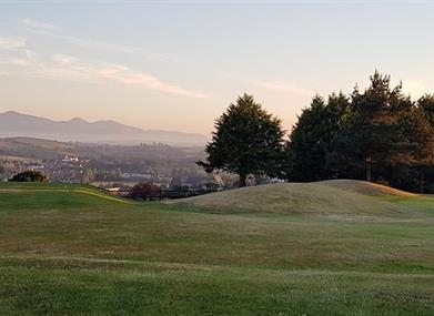
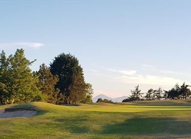
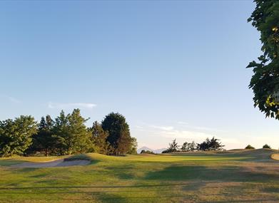
This parkland course measures 6,120 yards, and with tight tree lined fairways, fast and true greens and well placed bunkers provides a serious test of shot making. Holes of note are the difficult first, the par four seventh with views from the Isle of Man to Slemish Mountain in Antrim with County Down in between, and the par three eleventh, one of the most challenging par threes in Northern Ireland.

Golf Club:
Type of course: Parkland Course professional: Yes

Best days to play:
Any day except Saturday.

SSS:
69

Length in yards:
6,120

Par of course:
69

Course designer:
Martin Hawtree

Handicap/certificate requirements:
None required

Facilities

Attraction Facilities

  • 18 holes
  • Club Hire
  • Dress code
  • Golf buggies
  • Pro shop
  • Putting Green
  • Trollies available

Catering

  • Restaurant on site

Establishment Features

  • Tuition Available

Guide Prices

Please contact St Patrick's Golf Club directly for Green Fees

Route Guides

Add St Patrick's Golf Club to your Itinerary

Check availability for St Patrick's Golf Club (opens in a new window)

Close window

Call direct on:

Tel +44 (0) 28 4461 5947

Map & Directions

What's Nearby

  1. Built 1954 to the designs of S. McIlveen of Ferguson and McIlveen, Belfast. This is a…

    0.82 miles away
  2. Located in the heart of Downpatrick, Down Arts Centre is the operational base for the…

    0.89 miles away
  3. Two miles outside Downpatrick is the replica of St Patrick's first church in Ireland.…

    0.89 miles away
  1. The foundation stone of this church was laid by Bishop Dorrian in 1886.

    0.97 miles away
  2. The Reserve provides a relaxing natural retreat and offers visitors tranquil riverside…

    0.99 miles away
  3. Down County Museum is located in the old county Gaol of Down. It houses fascinating…

    1.03 miles away
  4. The Saint Patrick Centre is the only permanent exhibition in the World about Ireland’s…

    1.05 miles away
  5. Struell Wells was built around a stream flowing through a secluded valley. It was a…

    1.11 miles away
  6. Down Cathedral, a Cathedral of the Church of Ireland with magnificent stain glass…

    1.14 miles away
  7. Travel back to the past with real vintage steam trains through St. Patrick's Country,…

    1.23 miles away
  8. Located on the north bank of the Quoile River, Inch Abbey was founded by John de Courcy…

    1.34 miles away
  9. Interactive Medieval history Village, offering the opportunity to step back in time and…

    2.95 miles away
  10. Restored ruins of a sixth century church of St. Tassach, said to have given the last…

    3.02 miles away
  11. Situated on the shores of Strangford Lough in an area of outstanding natural…

    3.32 miles away
  12. The imposing Strangford Stone is the tallest megalith in the British Isles.  It was…

    3.6 miles away
  13. Situated 8.8km south east of Ballynahinch, on the north east shore of Loughinisland Lake,…

    4.33 miles away
Previous Next

Map & Directions

Road Directions

Directions from Town:
25 miles south of Belfast on the A7 and 1.5 miles from Downpatrick on the Saul Road.

View Maps and Visitor Guides
View what the Mourne Mountains & Ring of Gullion has to offer and some of the best things to see and do during a visit.
E-newsletter sign up
Sign up for the Mourne Mountains & Ring of Gullion newsletter for inspiration and travel tips.
Back to Top

Visit Mourne

Tourism Northern Ireland

Geopark

>

Don't Miss