Official tourism website for Mourne Mountains and Ring of Gullion
En

The GI Trail

The Nautilus Centre, Kilkeel, Co Down, BT34 4AX
The GI Trail

Book Tickets Online

About

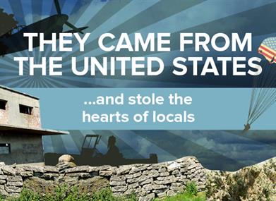
The GI Trail aims to map out the sites and locations at which the American GIs were based in Northern Ireland during the Second World War; it will research, develop, interpret, protect and promote these sites. The project will link in all the groups, local guides, visitor attractions and built heritage relating to that time.

The GI Trail will be completed in stages, creating 3 separate heritage-tourism trails covering Armagh and Down, Antrim and Londonderry and Fermanagh and Tyrone. Each trail will document the sites and the stories, exploring the legacy the GIs left here in Northern Ireland. You can find the trails at your local Visitor Information Centre and other community buildings and organisations throughout Northern Ireland.

If you want to delve deeper into this fascinating history, our interactive website will include much more detailed information and many extra sites to accommodate the Second World War enthusiasts. These sites can be added into the existing itineraries and enjoyed by all. The website will also keep you up to date with all the events throughout Northern Ireland related to the American presence and the Second World War, such as GI Jive which takes place in Kilkeel, County. Down.

Have you got any information relating to the GIs in NI? If so please get in contact and we can add your stories to the website

Add The GI Trail to your Itinerary

Close window

Call direct on:

Tel +44 (0) 28 4176 2525

Map & Directions

What's Nearby

  1. The Nautilus Centre overlooks Kilkeel's busy and picturesque fishing port and houses the…

    0 miles away
  2. Provides a first class service for visitors to Northern Ireland and for local residents.

    0.13 miles away
  3. Cranfield West offers a gently sloping, mainly sandy beach located at the entrance to…

    3.72 miles away
  1. The Silent Valley Reservoir was built to gather water from the Mourne Mountains and is…

    4.2 miles away
  2. Commanding the mouth of Carlingford Lough, the Castle has an eventful history. It was…

    4.3 miles away
  3. Annalong Cornmill has been beatifully restored and is situated by the pretty Annalong…

    5.21 miles away
  4. This beautiful area has superb views and good walking routes over Carlingford Lough.…

    8.09 miles away
  5. Kilbroney Park features riverside walks and an arboretum. There is a two-mile forest…

    8.24 miles away
  6. 'Cill Bhronaigh', or Bronagh’s Church (12th century), is located in the graveyard just…

    8.33 miles away
  7. The Electric Brae is a hill at which Newton's discovery, the law of gravity, is defied…

    8.56 miles away
  8. Spelga Dam Reservoir sits in the heart of the Mourne Mountains, located approximately 10…

    8.56 miles away
  9. "Where the Mountains of Mourne sweep down to the sea" (Percy French)

    The popular song…

    9.16 miles away
  10. Our play farm offers a huge indoor soft play area with four dragon slides and a massive…

    10.28 miles away
  11. Situated on the "Winding Road to Clanawillan" (Trassey Road), Meelmore Lodge is the best…

    10.39 miles away
  12. Warrenpoint Beach is located alongside the Mourne Mountains on the shores of Carlingford…

    10.54 miles away
  13. Donard park is a beautiful park located in the lovely town of Newcastle County Down, next…

    10.78 miles away
Previous Next

Map & Directions

View Maps and Visitor Guides
View what the Mourne Mountains & Ring of Gullion has to offer and some of the best things to see and do during a visit.
E-newsletter sign up
Sign up for the Mourne Mountains & Ring of Gullion newsletter for inspiration and travel tips.
Back to Top

Visit Mourne

Tourism Northern Ireland

Geopark

>

Don't Miss