Official tourism website for Mourne Mountains and Ring of Gullion
En

Ballymoyer Woodland

Co Armagh
Ballymoyer Woodland

Book Tickets Online

About

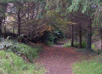
The route leaves from the car park at the Junction of Ballymoyer Road and Drumcrow Road. It initially follows the Creggan River and then winds it way through the mixed woodland of a fairy glen with deep mossy and ferned banks before returning back to the starting point

Start Point:
H978312

Finish Point:
H978312

Route:
Start at the carpark at the junction of Ballymoyer Road and Drumcrow Road. Follow the path through the gate alongside the Creggan River until it joins the Ballymoyer Road. Follow the trail and waymarkers on the opposite side to the viewpoint and through the looped top section that traverses the steep glen. From the viewpoint cross the road again and return via the Creggan River path to the starting point.

Distance:
2 miles

Terrain:
Off road woodland trail
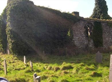
Point of interest:
Diverse woodland and specimen trees

Facilities:
Car parking at the start of the walk. Refreshments, shops and toilets in Whitecross.

Publication:
Ballymoyer - leaflet produced by National Trust

Publication availability:
Contact Newry Tourist Information Centre on 028 3031 3170 or contact the National Trust on 028 9751 0721 or email - info@smtp.ntrust.org.uk

Nearest town:
Whitecross

OS map:
Sheet 28

Accessible terrain:
Parts of the walk are wheelchair users - with low gradients.

Facilities

Provider Preferences

  • Free (parking charges may apply)

Map & Directions

What's Nearby

  1. Ballymoyer Old Church, in the churchyard of St. Luke’s Church of Ireland parish, is a…

    0.8 miles away
  2. A ¼ acre garden in a 19th century linen village. As the garden is divided into areas…

    4.71 miles away
  3. A National Trust Property, Derrymore House is an elegant thatched cottage that stands…

    5.16 miles away
  1. Phil’s Farm is the biggest and most diverse animal farm in Northern Ireland. We are…

    5.35 miles away
  2. This 18 arch viaduct, close to Newry, is a prominent feature of the south Armagh…

    5.63 miles away
  3. This Neolithic burial site, dated between 4000 and 2500 BC, has a huge capstone,…

    6.22 miles away
  4. The site contains two early churches situated back to back. Even earlier, it was the…

    6.83 miles away
  5. This monument is an extremely well preserved Neolithic burial site with three chambers. …

    6.97 miles away
  6. Newry Town Hall hosts theatre performances, education programmes, local amateur groups,…

    7.23 miles away
  7. This is undoubtedly the most commanding building in Newry and is arguably the most…

    7.27 miles away
  8. Bagenal’s Castle located in historic Newry is a 16th century fortified house and…

    7.39 miles away
  9. Corliss Fort is one of the best-preserved bivallate raths in County Armagh.

    7.42 miles away
  10. Dating from the Iron Age period around 10 BC, the enclosure comprises two roughly…

    7.42 miles away
  11. Leisleitrim Fort is a fine example of a multivallate rath ( a rath with several banks and…

    7.42 miles away
  12. This unusual megalithic monument is set on the eastern edge of a low ridge, overlooked by…

    7.78 miles away
  13. The Slieve Gullion Forest Trail, a magnificent 10km Scenic Forest Drive will be…

    8.54 miles away
Previous Next

Map & Directions

Road Directions

Access from Ballymoyer Road between Whitecross and Newtownhamilton

Public Transport Directions

Translink - journeyplanner.translink.co.uk

View Maps and Visitor Guides
View what the Mourne Mountains & Ring of Gullion has to offer and some of the best things to see and do during a visit.
E-newsletter sign up
Sign up for the Mourne Mountains & Ring of Gullion newsletter for inspiration and travel tips.
Back to Top

Visit Mourne

Tourism Northern Ireland

Geopark

>

Don't Miss