

Book Tickets Online
About
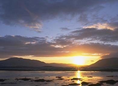
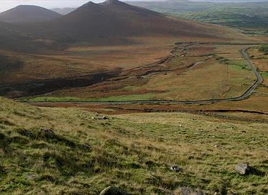
This route is almost entirely off road, traversing the foothill of the Mourne Mountains from Newcastle to Rostrevor on Carlingford Lough. The Mourne Area of Outstanding Natural Beauty is a unique, largely granite landscape shaped by ice and man, with stunning vistas of coast, sea and countryside.
Start Point:
J376311
Finish Point:
J185180
Route:
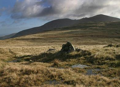
This is a challenging yet rewarding walk, some of which crosses open hill side with no waymarking so please ensure you are adequatley prepared. There is little accommodation available along the route so please ensure to make arrangements prior to setting off. This marvellously varied, two-day walk carries you from the coast, across the edge of the Mourne Mountains, and back to the sea at the opposite side of the range. Almost all of the distance is off-road, with forest trails and mountain paths predominating. Highlights include a climb to 500m at the summit of Butter Mountain.
Section 1 - Newcastle to Tollymore Forest Park
The route begins by climbing from urban parkland to a series of high forest tracks. From Newcastle Visitor Information Centre, cross the road and turn right. Just before the Shimna bridge, turn left into Castle Park. Follow a paved footpath past the boating lake and cross the busy Shimna Road. Continue across Islands Park to a footbridge. Cross the bridge and follow a path along the river, past a series of recreational facilities. Leave the park and turn left along Bryansford Road. Cross a bridge, then turn right onto a track known as Tipperary Lane. This leads you into Tipperary Wood, an enclave of deciduous woodland on the banks of the Shimna River. Climb through the trees and past several houses to reach a road. Head right here for 400m, then turn left onto a narrow lane. Climb steeply now to reach the gate that bars the end of the road. Cross the adjacent stile and continue to a second gateway that marks the boundary of Tollymore Forest. For the next 6.5km you'll be following tracks and footpaths through Tollymore Forest Park. Begin by climbing to a track, then turn left. The track swings round to the right and starts to descend. Turn left at the next junction and skirt along the stone wall that marks Tollymore's southern boundary. The mountain that rises on your left is Slieve Commedagh, the second highest summit in Northern Ireland at 767m. Keep left at the next two junctions, descending to meet the Spinkwee River. Cross Hore's Bridge then turn right, soon passing the beautiful, 10m-high Cascade Falls. The section ends at a track junction at the bottom of the Spinkwee River.
Did You Know? The woodlands of the Tollymore estate have long served the dual purpose of pleasure and commerce. Oak wood from this forest was the preferred material for the interiors of the mighty White Star shipping liners, including the ill-fated Titanic which was built in Belfast in 1911.
Section 2 - Tollymore Forest Park to Happy Valley
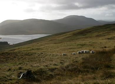
This section brings you out of the trees and into the wild terrain of the Mourne Mountains. Turn right at the junction at the bottom of the Spinkwee, then look out for a path on the left that descends to a set of stepping stones over the Shimna River. These stepping stones date back over 200 years, but if the water is too high to cross, turn around and retrace your steps back to the Spinkwee junction. Continue straight along the river's southern bank and cross the Shimna via a wooden footbridge some 500m further upstream. Once on the northern bank of the river, turn left onto a beautiful stretch of path that follows the chutes and rapids upstream. Pass another set of stepping stones, then turn left across Parnell's Bridge. Now turn immediately right onto a track, and continue straight ahead at the next junction. A sign soon indicates the location of the King's Grave, which dates from 1500-1000 BC. Continue past several stiles and turnstiles to reach a road. Just 20m away to the left, you'll see a gated track. This is the Trassey Track, one of the busiest walkers' routes into the Mournes. Cross the stile and follow the track south, passing two further gates before you reach open mountain terrain. At the final gate, a stone wall can be seen extending west; this is your guide for the next part of the route. Turn right onto a footpath and follow the wall, passing beneath the steep northern slopes of Slieve Meelmore. After almost 2km you arrive a stream that drains the Happy Valley between Slieve Meelmore and Slieve Meelbeg. Did You Know? The Trassey Track is the end of a path known as the Brandy Pad, which crosses the heart of the Mournes and meets the coast just south of Slieve Donard. The route was used in the 18th and 19th centuries by smugglers, who journeyed across the mountains at night with ponies laden with tobacco, wine, spirits and silk.
Section 3 - Happy Valley to Spelga Pass
You now climb across a 500m summit on the most mountainous section of the route. From Happy Valley, continue to follow the path around the northwestern base of Slieve Meelbeg. You soon arrive at Fofanny Reservoir. Cross a metal footbridge and head along the eastern bank of the reservoir, following a narrow path flanked by gorse bushes. A short section through pine trees then brings you to a road. Turn left here and walk along the tarmac for 900m to reach Blue Quarry car park (also known as Ott Mountain car cark). Here there's a choice of routes. The official route to Spelga Pass crosses open mountainside and is not waymarked. Only consider this option in clear weather, if you're an experienced mountain walker with good navigational skills. Otherwise, take the alternative route along the road. To follow the mountain trail, climb the stone steps and cross the stile above the car park. Follow a faint grassy trail directly up the slope to the top of the ridge. The 500m-high summit of Butter Mountain, the highest point of the route, lies just to the left, and provides fantastic views over the northwestern Mournes. Now follow the ridge northeast to a fence, which is marked by Mourne Way signs. Turn left and follow the fence for 600m. Now turn left (southwest) and follow a faint track through boggy tussock grass, past the summit of Spaltha. Continue to the broad col beneath Spelga Mountain, then turn right (west) and descend steeply, keeping just south of a stream. Keep descending until you meet a stone wall, where you rejoin the waymarkers. Turn left and contour along the wall to reach the road at Spelga Pass. Did You Know? This route takes you past two important mountain reservoirs. First is Fofanny Reservoir, with an underground water treatment works capable of processing 52 million litres of water a day. Second is the larger Spelga Reservoir, which was completed in 1957 and flooded a mountain pasture previously known as Deer's Meadow.
Happy Valley Facilties
Car parking Regular Spaces - 5
Picnic Tables - 2
This area is covered by Mourne shuttle bus service. Additional car parking and toilets are available at Meelmore Lodge. The Mourne Rambler stops during July and August only.
Section 4 - Spelga Pass to Leitrim Lodge
Follow a series of upland paths and tracks on your way between three mountain valleys. Cross the road at Spelga Pass and pass through two metal gates. Now descend across a footbridge that spans the nascent River Bann. Turn right on the opposite bank and contour around the base of Slievenamiskan. The route then turns right and descends across a hollow, heading towards a stone wall that runs around the base of Hen Mountain. When you meet the wall, turn left and contour beneath the northern slopes of the mountain. The path is sometimes wet underfoot, but brings you to the firm surface of a mountain track known as the New Bog Road (or Hen Track). Turn left here and follow the track for 2km, climbing gradually along the Rocky River valley. At first there are good views of the granite tors that decorate the summit of Hen Mountain - a popular rock climbing venue - then the feeling of isolation increases as you continue into the upper part of the valley. Follow the track towards Pigeon Rock Mountain, then turn right and cross a ford over the Rowan Tree River. Turn right again on the opposite bank and descend over rough ground to a footbridge across the Rocky River. Now begin to climb west up an open mountain slope, heading for the col between Rocky Mountain and Tornamrock. A faint path indicates the route across the sometimes wet ground (raised bog). The path consolidates at the col, and a steady descent brings you to a track at the base of the valley. Turn left here to reach the end of the section, marked by a track junction at Leitrim Lodge.
Did You Know? This section starts by crossing the nascent River Bann. Rising just 12km from Northern Ireland's southeast coast, this river eventually flows into the sea near Coleraine, at the opposite end of the province. Passing first through Spelga Reservoir and then through Lough Neagh, its 129km journey makes it the longest river in Northern Ireland.
Section 5 Leitrim Lodge to Yellow Water Picnic Area
A mixture of tracks and footpaths lead out of the mountains and into the pines of Rostrevor Forest. At the track junction near Leitrim Lodge, turn left and begin to contour southwest along the base of Altataggart Mountain. You are now within the old Batt's Estate and tall scots pine trees lie scattered across the hillside, providing a welcome vertical dimension after the previously bare slopes. The track soon veers right at a forestry plantation, but you should keep straight ahead along a rough footpath that follows along the edge of the trees. Pass around the plantation and continue back out into the open. The trail climbs briefly onto the lower slopes of Tievedockaragh, then descends to a stile. Cross this and join the firmer terrain of a gravel forest track. You are now inside the grounds of Rostrevor Forest, though most of the initial trees have been felled and the slopes remain relatively open for at least a kilometre. Across the valley to your right, a cluster of outlying hills mark the gradual demise of the Mourne Mountains as the peaks merge back into the rolling countryside. Before long the track plunges into thickly-planted pine trees and you arrive at a T-junction with another track. This marks the access point for Yellow Water Picnic Area, and the end of the section.
Did You Know? The name Altataggart translates from the Gaelic as 'Hill of the Priest'. It refers to the fact that this mountain was a site of clandestine religious worship during the period of penal law in the 18th century. The mass rock is located part-way up the mountain, just above the present-day forest.
Section 6 Yellow Water Picnic Area to Kilbroney Park
A gradual descent along a forest track carries you easily to the finish above Carlingford Lough. Begin by turning left at the T-junction near Yellow Water Picnic Area. Just 30m later, turn right and cross a wooden footbridge over the Yellow Water River. Climb to the end of a track and turn right, beginning to contour along the hillside through dense pine trees. Where there are gaps in the vegetation, there are good views over the fertile Kilbroney River valley. As you progress the panorama extends south to include the town of Rostrevor, with Kilbroney Church on its northern edge. This church lies on the site of a former convent founded in by St Bronach in the 6th century, and the whole scene is backed by the tidal waters of Carlingford Lough. The track passes several junctions, but the route is always well signed and generally continues straight ahead. As you near the end of the section, you begin to descend steadily through the trees. Pass the camping ground and join the bottom of the tarmac forest drive. Cross over a stone bridge and 200m later you will arrive at the main car park for Kilbroney Park, the official end point of the route.
Did You Know? Kilbroney Church is the location of the legend of St Bronach's Bell. The story recalls an invisible bell that rang in the churchyard during storms, continuing St Bronach's work of caring for troubled sailors. The apparently supernatural origin of the noise was explained in 1795 however, when an ancient oak tree blew down, revealing a 9th-century church bell that had been hidden in its branches during the reformation. Please be aware that this walking route passes through areas of open land such as hillside, working farmland and working forests. Livestock may be present, ground conditions may be uneven or wet underfoot and all forestry signage should be adhered to.
Distance:
26 miles
Terrain:
Mixed mountain terrain
Point of interest:
Mourne landscape, amazing views, wildlife, Mourne Wall
Facilities:
Various car parks along the route. Disabled toilets are located in Tollymore Forest Park, Newcastle and in Kilbroney Park, Rostrevor. Please Note the main car park at Kilbroney Park closes at 5 p.m. A wide range of B&B, guesthouse, hotel and hostel accommodation is available in Newcastle at the start of the section. There is an adequate range of Bed and Breakfast accommodation in Rostrevor with a campsite in Kilbroney Park right at the end of the section. There are no significant refreshment stops along the route between Newcastle and Rostrevor but Meelmore Lodge offers hostel accommodation, camping and a coffee shop (Sat and Sun 9a.m - p.m.) approximately 7.5 miles along the route at GR J306307. The Cnocnafeola Centre/ Mourne Hostel based off the route in Attical also offers prearranged transfers to and from Ott Car Park. For further information on accommodation along this route check out https://www.visitmournemountains.co.uk/accommodation
Publication:
Mourne Waymarked Way Guide.
Publication availability:
Contact Newcastle Visitor Information Centre T (0) 330 137 4046. Alternatively, view a digital version of the guide here.
Nearest town:
Newcastle, Rostrevor
OS map:
Sheet 29
Accessible toilet facilities:
Yes
Accessible terrain:
The route follows forest paths and mixed mountain terrain. Steep in places.
Book Tickets
Facilities
Provider Preferences
- Free (parking charges may apply)


