Official tourism website for Mourne Mountains and Ring of Gullion
En

Ring of Gullion

89 Drumintee Road, Killeavy, County Armagh, BT35 8SW
Group on lane looking over Ring of Gullion mountains

Book Tickets Online

About

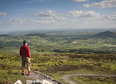
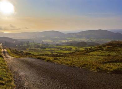
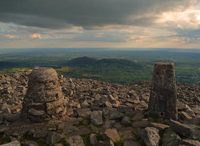
Slieve Gullion Forest Park is in the heart of the Ring of Gullion. The Ring of Gullion is a unique geological landform – unparalleled elsewhere in Ireland or the UK – and was the first ring dyke in the world to be geologically mapped. The ring of low, rugged hills forms a ‘rampart’ around the heather-clad Slieve Gullion. Rich semi-wild habitats of heath, bog and woodland contrast with the neatly patterned fields and ladder farms. Slieve Gullion’s mysterious reputation arises from its associations with myths and legends and the wider area’s rich archaeological heritage. 

It has been said of South Armagh that you can ‘kick any stone’ and it will tell a story… 

Click here for more information about Slieve Gullion Forest Park

Add Ring of Gullion to your Itinerary

Close window

Call direct on:

Tel +44 (0) 330 137 4046

Map & Directions

What's Nearby

  1. Follow Fionn's Giant Adventure (previously known as the Giant's Lair) at Slieve Gullion…

    0 miles away
  2. The Slieve Gullion Forest Trail, a magnificent 10km Scenic Forest Drive will be…

    0 miles away
  3. Slieve Gullion Passage Tomb, dramatically situated on the southern end of the Slieve…

    0 miles away
  1. Slieve Gullion is Ireland's Mountain of Mystery. Slieve Gullion Forest Park offers…

    0 miles away
  2. This unusual megalithic monument is set on the eastern edge of a low ridge, overlooked by…

    0.97 miles away
  3. The site contains two early churches situated back to back. Even earlier, it was the…

    1.87 miles away
  4. Kilnassagart Inscribed Stone, in the south of County Armagh, is regarded as being one of…

    2.83 miles away
  5. South of the County Armagh village of Jonesborough lie the ruins of Moyry Castle, built…

    2.88 miles away
  6. This Neolithic burial site, dated between 4000 and 2500 BC, has a huge capstone,…

    3.31 miles away
  7. This monument is an extremely well preserved Neolithic burial site with three chambers. …

    3.37 miles away
  8. Known locally as the ‘King’s Ring’, this court tomb has a prominent position in the…

    3.43 miles away
  9. Excellent example of a tower-house and bawn built about 1568 at a point where the Newry…

    5.09 miles away
  10. Bagenal’s Castle located in historic Newry is a 16th century fortified house and…

    5.17 miles away
  11. Leisleitrim Fort is a fine example of a multivallate rath ( a rath with several banks and…

    5.21 miles away
  12. Corliss Fort is one of the best-preserved bivallate raths in County Armagh.

    5.21 miles away
  13. Dating from the Iron Age period around 10 BC, the enclosure comprises two roughly…

    5.21 miles away
Previous Next

Map & Directions

View Maps and Visitor Guides
View what the Mourne Mountains & Ring of Gullion has to offer and some of the best things to see and do during a visit.
E-newsletter sign up
Sign up for the Mourne Mountains & Ring of Gullion newsletter for inspiration and travel tips.
Back to Top

Visit Mourne

Tourism Northern Ireland

Geopark

>

Don't Miss