

Book Tickets Online
About
Where is Slieve Gullion Passage Tomb?
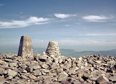
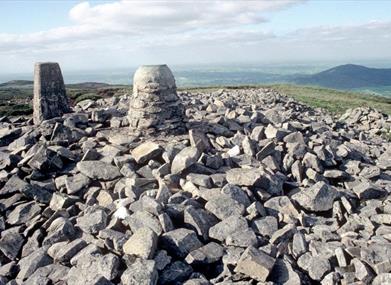
Slieve Gullion Passage Tomb, dramatically situated on the southern end of the Slieve Gullion summit ridge at an altitude of over 570m. This is the highest surviving passage tomb in in the British Isles with stunning views over the surrounding countryside. Known locally as 'Cailleach Beara's House' it consists of a circular cairn some 30m in diameter and up to 4m high, with a kerb of massive, but undecorated, stones around the perimeter. A slight indentation on the south-west marks the entrance to a short, lintelled, passage which leads to the octagonal, originally corbelled, chamber.
Public Notice: The chamber of the Southern Cairn on the summit of Slieve Gullion (known locally as Cailleach Beara's House) is closed (until further notice) for essential maintenance.
When was the earliest excavation of the Slieve Gullion Passage Tomb?
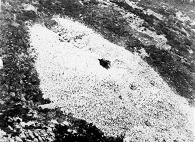
The earliest documented investigation of Slieve Gullion Passage Tomb dates to 1789, when the chamber was opened by locals searching for the old lady or Cailleach Beara, but only a few human bones were found. Not surprisingly, excavation in 1961 revealed that the chamber had been badly disturbed and the only small finds were a few pieces of worked flint, a single scraper and an arrowhead. Two of the stone basins, commonly found in passage tombs, were also discovered below modern fill in the chamber and a third (now housed in Armagh County Museum) was recovered from the outer end of the passage.
What did the excavation of the Slieve Gullion Passage Tomb reveal?
Excavation of Slieve Gullion Passage Tomb also revealed that a small cairn of stones, about 12m in diameter, had subsequently been added to the northern side of the tomb. Although no burials or structural features were uncovered by the excavation, it seems reasonable to interpret this as a Bronze Age addition. A small round cairn on the northern end of the summit ridge was also excavated in 1961 revealing two small cist graves and fragments of distinctive Early Bronze Age pottery.
Links between Slieve Gullion, Fionn Mac Cumhaill and Cailleach Beara
Slieve Gullion dominates the landscape of the area and plays a central role in many folk tales. Several link Fionn Mac Cumhaill with the mountain, and one wellknown story involves the Cailleach Beara, who entices Fionn to swim in the magical lake on the summit of the mountain, only for him to emerge as an old and weak man.


