Official tourism website for Mourne Mountains and Ring of Gullion
En

Warrenpoint Golf Club

Lower Dromore Road, Warrenpoint, County Down, BT34 3LN
Image of Warrenpoint Golf Course

Book Tickets Online

About

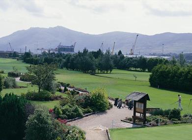
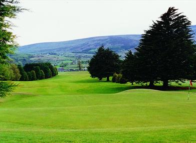
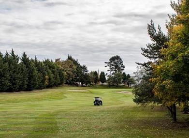
Warrenpoint is a very attractive parkland course overlooking Carlingford Lough. The course has accommodated several worthy professional events including the Irish Professional Championship and more recently a Ladies European Tour event. Warrenpoint has many excellent golf holes but special note must be made of the fine par 4 7th where accuracy off the tee is paramount to set up a difficult approach to a well-protected green. Also, the extremely tight 12th and 13th holes are two par 4's to test the most skilled of golfers. Warrenpoint's reputation as the finest "nursery" for young golfers in Ireland is highlighted by famed names such as Raymond Burns and Ronan Rafferty - surely a testimony to the quality of the course.

Golf Club:
Parkland Course professional: Yes

Best days to play:
Monday, Thursday, Friday and Sundays.

SSS:
71

Length in yards:
6,173

Par of course:
71

Course designer:
Tom Craddock.

Handicap/certificate requirements:
Required.

Facilities

Attraction Facilities

  • 18 holes
  • 9 holes
  • Golf buggies
  • Pro shop
  • Putting Green
  • Trollies available

Catering

  • Restaurant on site

Establishment Features

  • Tuition Available

Payment Methods

  • All major credit/debit cards accepted
  • Euros accepted

Guide Prices

Please contact Warrenpoint Golf Club directly for Green Fees

Add Warrenpoint Golf Club to your Itinerary

Check availability for Warrenpoint Golf Club (opens in a new window)

Close window

Call direct on:

Tel +44 (0) 28 4175 3695

Map & Directions

What's Nearby

  1. Excellent example of a tower-house and bawn built about 1568 at a point where the Newry…

    0.52 miles away
  2. Warrenpoint Beach is located alongside the Mourne Mountains on the shores of Carlingford…

    1.18 miles away
  3. Our play farm offers a huge indoor soft play area with four dragon slides and a massive…

    1.24 miles away
  1. Known locally as the ‘King’s Ring’, this court tomb has a prominent position in the…

    2.18 miles away
  2. Kilbroney Park features riverside walks and an arboretum. There is a two-mile forest…

    3.25 miles away
  3. 'Cill Bhronaigh', or Bronagh’s Church (12th century), is located in the graveyard just…

    3.36 miles away
  4. This beautiful area has superb views and good walking routes over Carlingford Lough.…

    3.42 miles away
  5. Leisleitrim Fort is a fine example of a multivallate rath ( a rath with several banks and…

    5.05 miles away
  6. Corliss Fort is one of the best-preserved bivallate raths in County Armagh.

    5.05 miles away
  7. Dating from the Iron Age period around 10 BC, the enclosure comprises two roughly…

    5.05 miles away
  8. Bagenal’s Castle located in historic Newry is a 16th century fortified house and…

    5.06 miles away
  9. This monument is an extremely well preserved Neolithic burial site with three chambers. …

    5.09 miles away
  10. This is undoubtedly the most commanding building in Newry and is arguably the most…

    5.2 miles away
  11. Kilnassagart Inscribed Stone, in the south of County Armagh, is regarded as being one of…

    5.3 miles away
  12. Newry Town Hall hosts theatre performances, education programmes, local amateur groups,…

    5.33 miles away
  13. This unusual megalithic monument is set on the eastern edge of a low ridge, overlooked by…

    5.5 miles away
Previous Next

Map & Directions

Road Directions

Directions from Town:
8 miles southeast of Newry.

View Maps and Visitor Guides
View what the Mourne Mountains & Ring of Gullion has to offer and some of the best things to see and do during a visit.
E-newsletter sign up
Sign up for the Mourne Mountains & Ring of Gullion newsletter for inspiration and travel tips.
Back to Top

Visit Mourne

Tourism Northern Ireland

Geopark

>

Don't Miss